Territory Map
 Territory maps allow polygons,
polylines, or points to be grouped into territories by defining a grid
or by hand selecting the areas for territories. The Property
Manager Territory and
Map pages
display information about the territory map including the active territory,
the territory name, fill color, number of objects in a territory, and
statistics.
Territory maps allow polygons,
polylines, or points to be grouped into territories by defining a grid
or by hand selecting the areas for territories. The Property
Manager Territory and
Map pages
display information about the territory map including the active territory,
the territory name, fill color, number of objects in a territory, and
statistics.
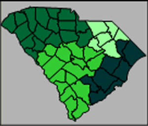
Territory maps can be made for polygons, polylines, or
points. The fill color is assigned to the territory's polygons,
polylines, or points.
Categorizing Objects
The territory map is used to group objects and report statistics based
on the groups. If you wish to assign colors to areas based on data, use
the hatch map instead. If you wish to categorize
points based on data, use a pin map. If you
wish to categorize curves, use a flow map.
Creating and Editing a Territory Map
Click the Map | Create Map | Territory
command  to create a territory map. Edit a territory
map in the Property
Manager.
to create a territory map. Edit a territory
map in the Property
Manager.
See Creating
and Editing Thematic Maps for information on creating a map, changing
a map to another map type, and changing map properties.
Territory Map Properties
The Property
Manager for a territory map contains General,
Data Labels, Info,
Map, and Territory
pages. Click the preceding hyperlinks for information on properties in
each of the property manager pages.
See Also
Legend
Property
Manager