You can set the units of various items in the plot window on the Units page of the Property Manager. The page unit (inches or centimeters) is set in the Options dialog General page. Plots without a defined coordinate system use Map Units for the default unit system. Opening or importing a map into the plot window loads the map's units to the plot properties.
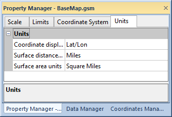
The Units page is located in the plot properties.

Specify the coordinate display, surface distance, and surface
area units in the Units page of the Property Manager.
Coordinate display units are used for displaying cursor position information in the status bar. You can display the units in Feet, Kilometers, or a host of other units of measurement.
The Surface distance units control the Analysis | Distance | Measure Distance display units and the length units in the Object Manager.
The Surface area units control the polygon units in the Object Manger.
See Also