Prism Map
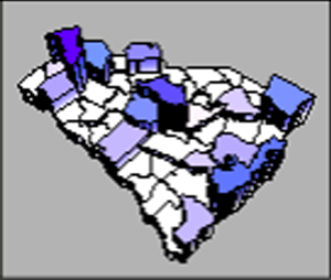
 Prism maps
draw each data linked polygon, polyline, or point as a raised prism, where
the height of the prism is proportional to the associated data value.
Vertical lines can be drawn on the prism sides indicating the position
of each vertex along the area boundary. Prism maps can be tilted and rotated
on the page for more effective displays. The prisms can also be colored
with one of three different coloring methods.
Creating and Editing a Prism Map
Click the Map | Create Map | Prism
command  to create a prism map. Edit prism map properties
in the Property Manager.
See Creating
and Editing Thematic Maps for information on creating a map, changing
a map to another map type, and changing map properties.
Prism Map Properties
The Property Manager
for a prism map contains General, Data
Labels, Info, 3D Settings, and Map
pages. Click the preceding hyperlinks for information on properties in
each of the property manager pages.
Map Page
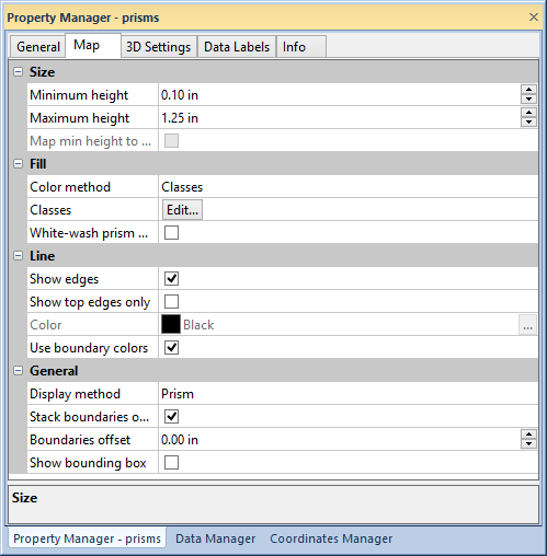
The Property Manager Map
page has prism size, line, fill, and display properties.

Edit prism map properties in the Map
page of the Property Manager.
Size
The Size group on the Map page sets the minimum and maximum
prism heights. Define the minimum and maximum prism heights by typing
a value in page units into the Minimum
height and Maximum height
fields. The prism heights can also be adjusted by clicking the  . The minimum and maximum
prism heights are applied to the boundary objects with the minimum and
maximum data values respectively. All prisms with intermediate data values
are scaled linearly between the minimum and maximum height.
Click the Map min height to data value
of 0 to force the minimum height to be associated with a data value
of zero regardless of the data minimum. The Use
absolute data value property on the General
page must be active to use the Map min
height to data value of 0 option. When Use
absolute data value is not active, the Map
min height to data value of 0 is disabled.
Fill
Select a fill type in the Color
method list. Click Classes,
Boundaries, or Colormap
to select a Color method.
When Classes
is the selected Color method,
prism objects are grouped in classes by data value, and independent fill
properties are applied to each class in the Color
Classes dialog. Click the  button in the Classes field
to open the Color Classes dialog.
If Boundaries
is the selected Color method,
prism objects use the fill color of the boundary objects used to create
the map. A fill pattern or bitmap can be applied to the prism map in the
Texture Mapping dialog. Click the  button in the Texture
field to open the Texture Mapping dialog.
If Colormap
is the selected Color method,
a gradient fill is applied to the prism map. Select a predefined color
spectrum from the Colors list,
or click the  button to create a custom colormap in
the Colormap dialog.
Click the White-wash
prism walls to apply the Color
method to the prism map faces only. The sides of the prisms will
be white when White-wash prism walls
is selected.
Line
The Line
section contains options for displaying prism lines. Click the Show
edges check box to draw lines along prism edges. Click the Show top edges only check box to
show only the edge around the prism faces. Select a line color by clicking
on the Color field and selecting
a color in the Color Palette.
Click the  button to select a color or create a custom
color in the Colors dialog.
Click the Use boundary colors
check box to apply the line color from the boundary objects to the prism
map edge lines. When Show
edges is not active, the Show
top edges only, Color,
and Use boundary colors
properties are disabled.
General
Select the Display method for
the prism map by clicking on the current selection and choosing Prism or Pyramid
from the list. Click the Stack boundaries
on map to show the base map above the prism map. When Stack
boundaries on map is checked the Boundaries
offset and Show bounding box
options are available. Set the boundary distance from the tallest prism
in the Boundaries offset field.
Type a value in page units or click the  buttons
to set the boundary offset. Click the Show
bounding box check box to show the bounding box around the
prism map.
See Also
3D Settings Page - Prism Maps
 Prism maps
draw each data linked polygon, polyline, or point as a raised prism, where
the height of the prism is proportional to the associated data value.
Vertical lines can be drawn on the prism sides indicating the position
of each vertex along the area boundary. Prism maps can be tilted and rotated
on the page for more effective displays. The prisms can also be colored
with one of three different coloring methods.
 to create a prism map. Edit prism map properties
in the
 . The minimum and maximum
prism heights are applied to the boundary objects with the minimum and
maximum data values respectively. All prisms with intermediate data values
are scaled linearly between the minimum and maximum height.
 button in the
  button to create a custom colormap in
the