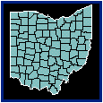

Base maps display polygon, polyline, or point boundaries without data representations. Base maps are useful as reference maps to simply show the location of objects. Boundaries can be areas (also called polygons), curves (which are lines or polylines), and points. Base maps can be used with other maps to show features such as roads, streams, city locations, boundaries that have no data associated with them, and so on. You can overlay base maps on other thematic maps by creating the base map on a separate MapViewer layer. After a base map is displayed, you can convert it to a thematic map by choosing the desired map command and specifying the data file to use for the map.
To create a base map from a boundary file,
1. Choose
the Map | Create Map | Base command
 and the Import
Files dialog is displayed.
2. Double-click the boundary file name in the Import Files dialog to open the base map in the map window.
Alternatively, you can select the File | Import command since the result is a base map from this command as well.
Properties for base map polygons, polylines, or points can be set by selecting the object and changing the properties in the Property Manager. Base map properties are edited in the Info and Data Labels pages of the Property Manager.
To create custom boundaries, refer to the Creating Custom Boundaries discussion.
If a thematic map is opened with the File | Open command and the associated data file does not exist, the map is automatically converted to a base map.
We have included some base maps with MapViewer. There are three- and five-digit ZIP code maps, county boundaries, country boundaries, as well as other maps. The most commonly used files are located in the SAMPLES folder and the rest are located on CD.
See Also