 button to display the Triangulation Options
dialog.
button to display the Triangulation Options
dialog. The Triangulation with Linear Interpolation method uses the optimal Delaunay triangulation. The algorithm creates triangles by drawing lines between data points. The original points are connected in such a way that no triangle edges are intersected by other triangles. The result is a patchwork of triangular faces over the extent of the grid. This method is an exact interpolator.
Each triangle defines a plane over the grid nodes lying within the triangle, with the tilt and elevation of the triangle determined by the three original data points defining the triangle. All grid nodes within a given triangle are defined by the triangular surface. Because the original data are used to define the triangles, the data are honored very closely.
Triangulation with Linear Interpolation works best when your data are evenly distributed over the grid area. Data sets that contain sparse areas result in distinct triangular facets on the map.
Specifying Triangulation with Linear Interpolation Options
In the Property Manager
Gridding
page, select Triangulation
with Linear Interpolation as the Gridding
method and then click the Advanced
Options
button to display the Triangulation Options
dialog.
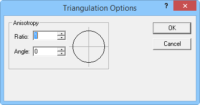
Change anisotropy options in the Triangulation Options dialog.
For more information about anisotropy options see Anisotropy.
Triangulation with Linear Interpolation References
See Also