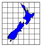
New Zealand
New Zealand Map Grid Projection
False Easting: 2510000
False Northing: 6023150
Scale = 1
The New Zealand Map Grid projection is a modified cylindrical projection and is conformal. It is a sixth-order conformal modification of the Mercator projection using the International spheroid. Scale is constant along any given parallel and is highly accurate for New Zealand. Scale is the same in all directions near any given point. Distortion is minimal near 173° East, 41° South, and becomes more distorted the further from this location. This projection should only be used for large-scale maps of New Zealand and is not useful outside of New Zealand.
Parameter |
Description |
Name |
Specifies the units used in the map. |
Scale |
Specifies the unit scale of the projected map, relative to meters. For example, a scale of one means one unit in the projected map equals one meter; a scale of two means two units in the projected map equal one meter; etc. |
False Easting |
Specifies the false easting, or horizontal offset, of the projected coordinates, in meters. False Eastings and False Northings are added to the underlying "projected" coordinates as a way to arbitrarily offset their internal XY coordinates after the projection. Unless you have a reason for using these offset values, do not change them. These values do not affect the latitude/longitude coordinates for the map, only the internal coordinates used to plot the map on the screen. If you use False Easting and False Northing offsets for a map, any subsequent boundaries you append to the map must also use these same offsets if you want the imported boundaries to be drawn in the correct relative position to the existing boundaries. |
False Northing |
Specifies the false northing, or vertical offset, of the projected coordinates, in meters. See above. |
See Also
Introduction to Map Projections
Characteristics of Projections
Latitude/Longitude Coordinates
Latitude/Longitude in Decimal Degrees
Using Scaling to Minimize Distortion in Latitude/Longitude Projects