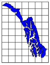
Aleutian Islands, Alaska
Hotine Oblique Mercator Projection
Scale = 1
False Easting = 0 False Northing = 0
Central Scale Factor = 1 Central Latitude = 0
Standard Parallel = 56 2nd Standard Parallel = 58
1st Meridian = -133 2nd Meridian = -135
Rotate U/V to X/Y = True
Offset by U = True
Projection Characteristics
The Hotine Oblique Mercator 2-Point projection is a cylindrical, conformal projection. The scale is accurate along the chosen central line by the longitude/latitude settings below. This projection is useful for oblique areas (areas that do not follow lines of latitude and longitude), such as the Alaska panhandle because the central line does not have to follow a line of constant longitude. This projection is typically used with areas that are state or province sized and it is not suitable for maps of the world. There are two forms of the Hotine projection equation. The Hotine Oblique Mercator 2-Point projection is defined by selecting two points to form a line (Alternate A, Snyder).
Projection Parameters
Parameter |
Description |
Name |
Specifies the units used in the map. |
Scale |
Specifies the unit scale of the projected map, relative to meters. For example, a scale of one means one unit in the projected map equals one meter; a scale of two means two units in the projected map equal one meter; etc. |
False Easting |
Specifies the false easting, or horizontal offset, of the projected coordinates, in meters. False Eastings and False Northings are added to the underlying "projected" coordinates as a way to arbitrarily offset their internal XY coordinates after the projection. Unless you have a reason for using these offset values, do not use them. These values do not affect the latitude/longitude coordinates for the map, only the internal coordinates used to plot the map on the screen. If you use False Easting and False Northing offsets for a map, any subsequent boundaries you append to the map must also use these same offsets if you want the imported boundaries to be drawn in the correct relative position to the existing boundaries. |
False Northing |
Specifies the false northing, or vertical offset, of the projected coordinates, in meters. See above. |
Central Scale Factor (KO) |
Specifies the central scaling factor for the projection. This value is often set to 1.0, but may be set to another value for specific applications. |
Central Latitude |
Specifies the central latitude of the projection in degrees. The Central Latitude value typically should be defined as the latitudinal center of the map you are going to produce, and should typically be defined as the center of the map. |
Standard Parallel |
Defines one end of the Y extent for the central line. |
1st Meridian |
Defines one end of the X extent for the central line. |
2nd Standard Parallel |
Defines the other end of the Y extent for the central line. |
2nd Meridian |
Defines the other end of the X extent for the central line. |
Rotate U/V to X/Y |
u,v are unrectified coordinates that follow the central line of the projection. x,y are rectified rectangular coordinates. When True, u,v are rotated to x,y. See Snyder page 70. |
Offset by U |
When True, u coordinates are offset to remove the Us center component, to normalize the origin of the u axis. This is typically required for State Plane coordinate systems that use the Hotine Oblique Mercator projection method. |
See Also
Introduction to Map Projections
Characteristics of Projections
Latitude/Longitude Coordinates
Latitude/Longitude in Decimal Degrees
Using Scaling to Minimize Distortion in Latitude/Longitude Projects