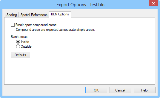
Specify the BLN export options in the Export Options dialog.
The Export Options dialog allows you to specify options which determine how information in the file is exported.
When exporting, the application specifies coordinates in Page Units (inches or centimeters) as indicated on the document rulers. You may want these values offset and/or scaled back to original map coordinates in the Golden Software Blanking .BLN file.
The first ID attribute for all polyline, polygon, and symbol objects are automatically exported to all .BLN files. For contour maps, the elevation is exported as the "STD_ID1" attribute for all polylines in the contour map. If a different attribute other than the first listed attribute for objects is desired, rename the desired attribute to "STD_ID1". This named attribute will be used instead of the first attribute listed on the Info tab. The color, size, symbol shape, width, and other properties are not exported.
Specify the BLN export options in the
Export Options
dialog.
Break Apart Compound Areas
Choose Break apart compound areas to have compound areas (those containing islands or lakes) output as separate area entities. This option should be chosen if the .BLN file is to be used as a boundary file. Do not choose this option if the .BLN file is to be used as a blanking file.
Defaults
The Defaults button sets all options to default conditions.
Scaling Page
See the Scaling Page for detailed information.
See Also