 .
.The map collar is the area outside the neat lines in a map. This collar
can contain tick marks and labels as well as information about the tick
units. Map collars are created by clicking the Map
| Add | Collar command .
Click the Map | Add | Collar command while the collar is visible to remove the map collar.
Map collar properties are located on the Collar and Collar Ticks pages in the Property Manager.
The Collar page is located in the plot properties.
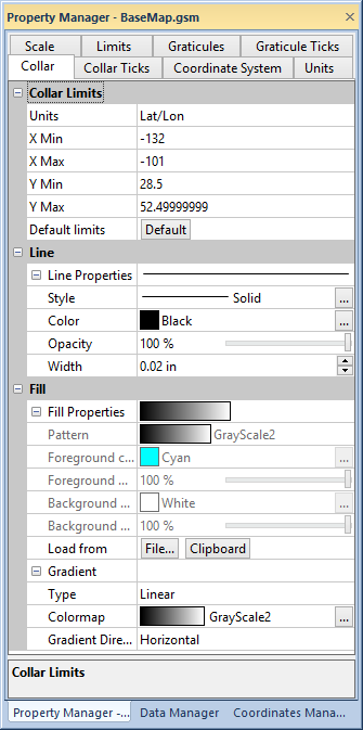
Set the collar limits, line, and fill properties on the Collar page
of the Property Manager.
The collar extent is set in the Collar limits group. Select the units for the limits in the Units list. If the projection is Unknown, the available units are Map Units, Page Inches, or Page Centimeters. Any other projection allows you to choose from the full list of available distance units.
Once the units are selected, set the limits in the X Min, X Max, Y Min, and Y Max boxes. Click the Default button to use the MapViewer default collar limits.
The collar line and fill properties are edited by clicking the properties in the Line and Fill sections.
Adding Additional Collar Information
A legend and annotation can be created outside the collar. Grid lines can be drawn with the Graticule command.
See Also